In northern New Hampshire, I ran into a section hiker heading south. He told me, “Maine is going to be good to you.” Now having completed the first 166 miles of Maine’s 281 miles of the trail, I can say he was right. While the trails in southern Maine were strenuous, nowhere on the AT have I had better trails, prettier scenery, friendlier towns, or more favorable weather.
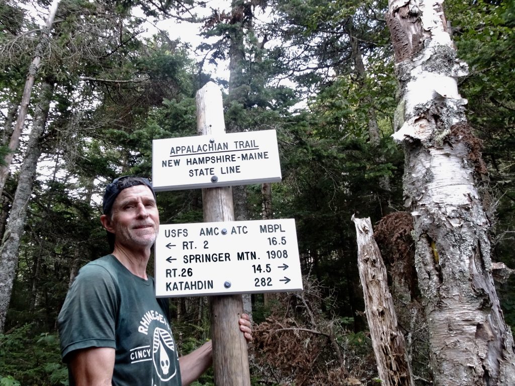
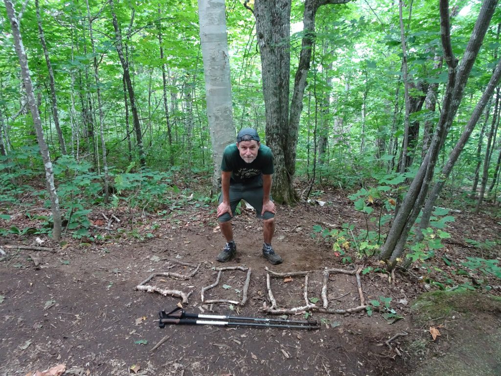
Reaching Maine and hitting the 2000-mile mark were big milestones for me. I had reached Maine after a long day of hiking. New Hampshire was relentless to the last mile. Going into the day, I knew I had to do 5,400 feet of elevation gain in just 14 miles, but I was in “Maine or bust” mode. By the time I reached the border, I was dog tired. I was not going to include my picture at the border crossing on the basis that I appeared thin (down to 146 pounds at my last weigh-in) and looked “rode hard and hung up wet”. My daughter and editor, Shelby, overruled, so for full disclosure, here it is.
The final state!
Only 190.9 miles to go
During my first day in Maine, I passed through Mahoosuc Notch, which has the reputation of being the “toughest mile of the AT”. The trail passes through a jumble of large boulders which have tumbled down, over many millennia, from the cliffs overhanging the notch. I did not find it very difficult, but it was tedious at times, (like crawling on my hands and knees under the boulders, dragging my pack behind.)
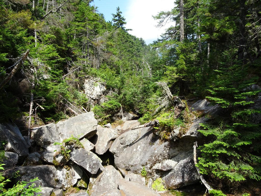
Mahoosuc Notch
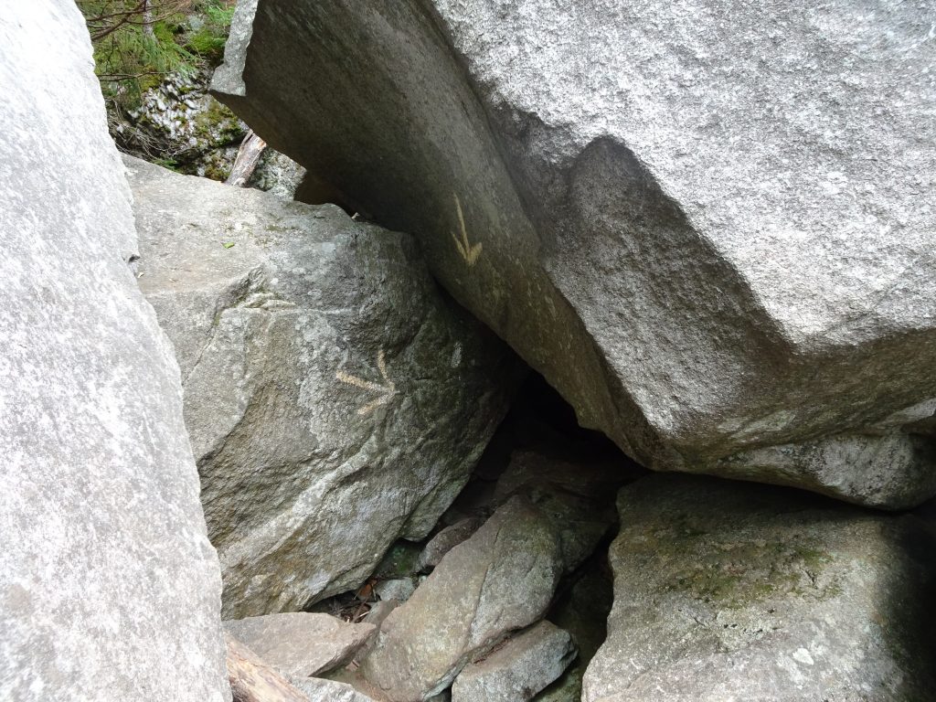
I am supposed to go under there???
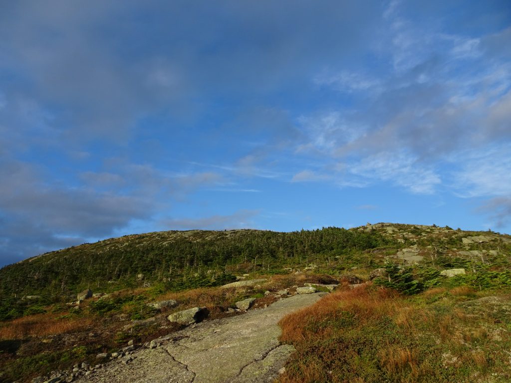
After the notch, I hiked up the “Mahoosuc Arm” which is just a long strip of exposed rock path that goes up the mountain. The arm serves as a reminder that you are really hiking on rock domes covered by only around six to twelve inches of dirt. One of the reasons that the spruce and fir trees dominate is that they require very little soil to flourish.
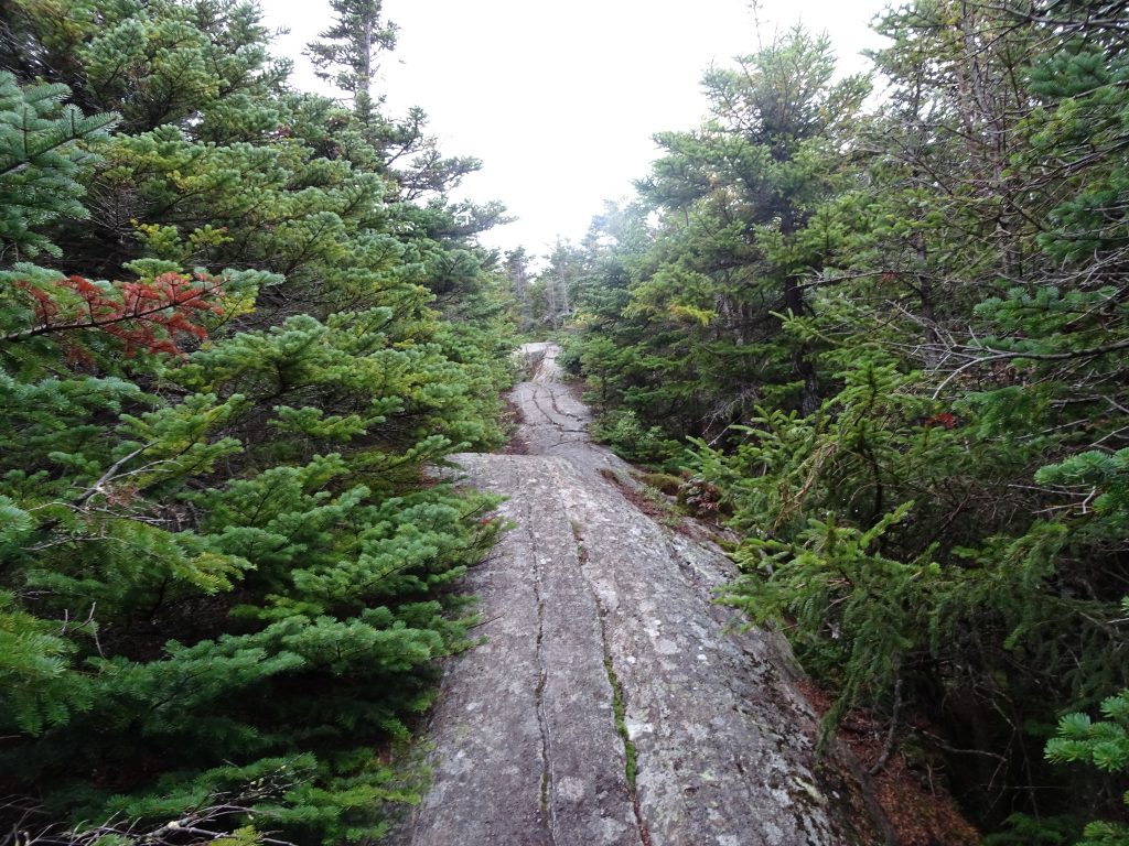
The “Mahoosuc Arm”
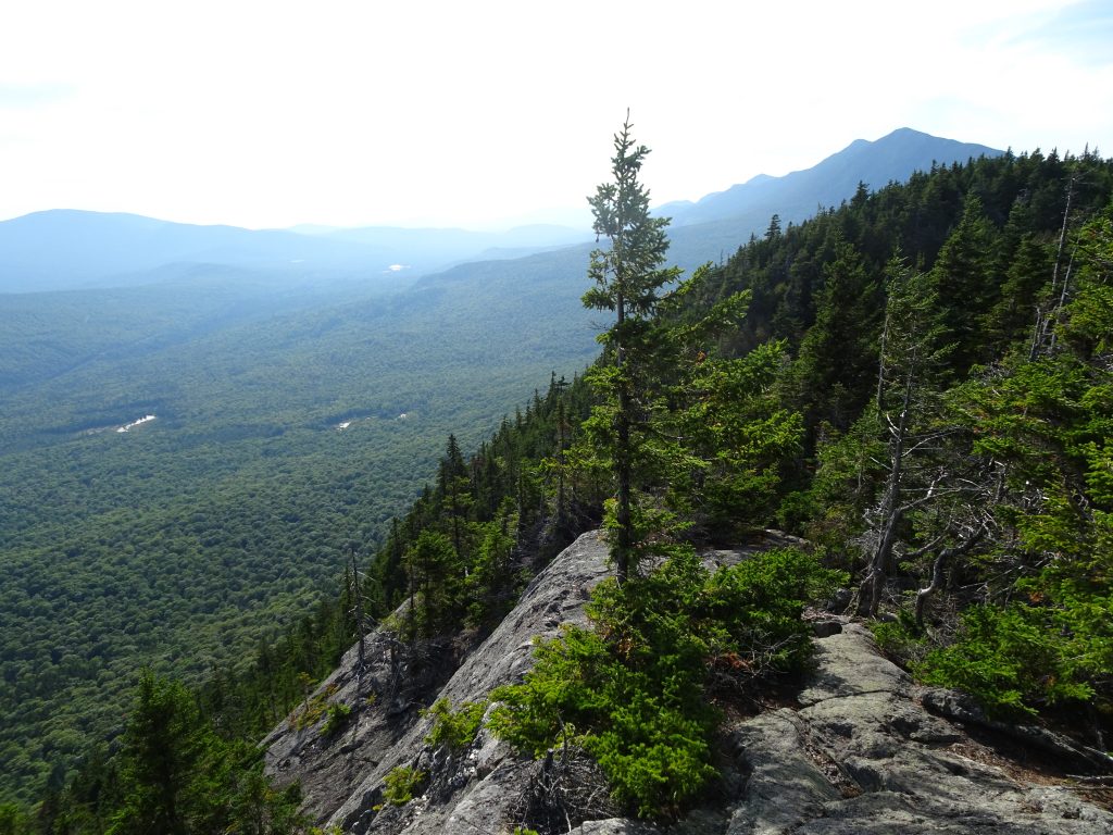
Not far past the notch, I came to Baldpate Mountain. While I had never heard of this mountain before, it would become one of my favorite climbs on the trail. To reach the summit, one just follows the rock cairns up the rock face. It is not so steep that you need to worry about falling. It is just a fun climb with amazing views all the way.
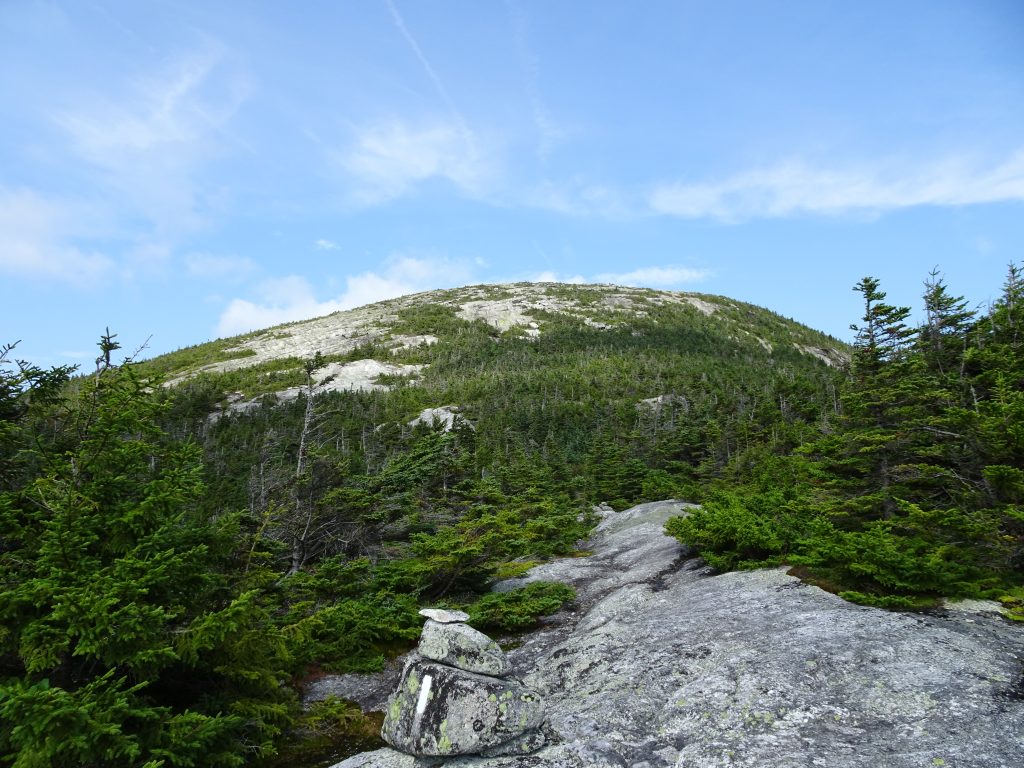
Baldpate Mountain from a distance
Following the cairns up Baldpate Mountain
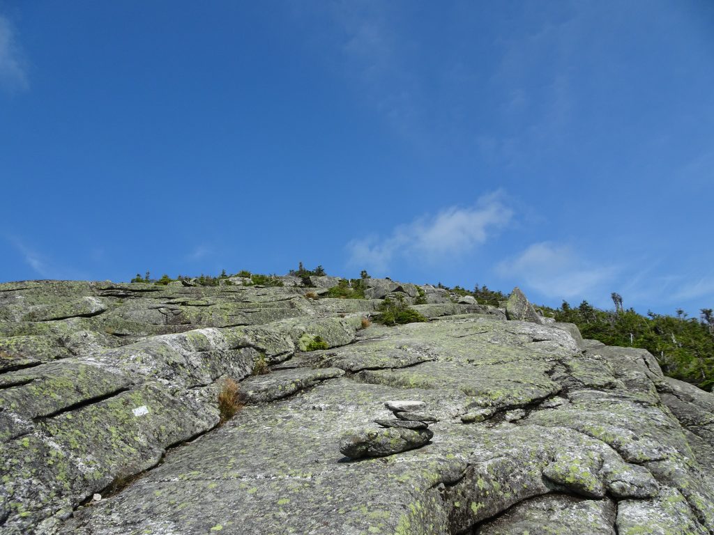
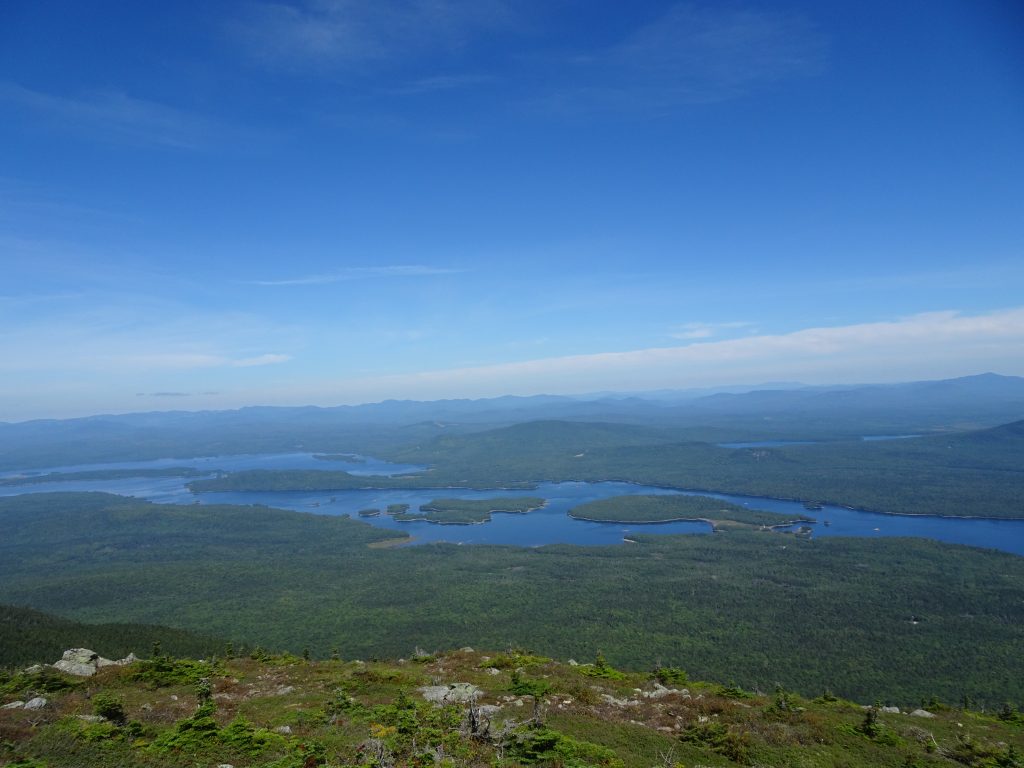
This was the first of many amazing mountains I would climb in Maine which I had never heard of before reaching the state. This would be a recurring theme. In Maine, the treeline is only at about 4,000 feet, so there are great 360-degree views from many of the mountaintops. I took many photos from these mountains, but unfortunately the pictures don’t capture the experience.
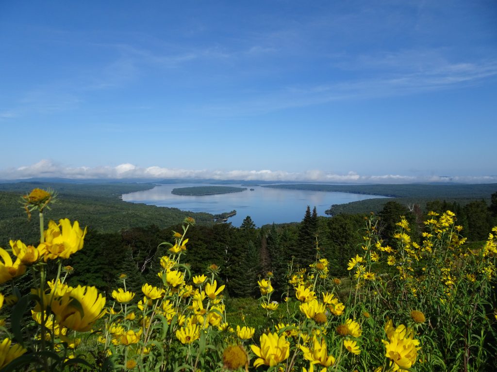
View of Mooselookmeguntic Lake
The Appalachian Trail passes through the High Peaks region of Maine which contains 8 of 14 of Maine’s official 4,000 footer mountains. Of these 4k peaks, the AT crests Saddleback Mountain, The Horn, Spaulding Mountain, South Crocker Mountain, and North Crocker Mountain.
Climbing up Saddleback Mountain on a Saturday evening, I couldn’t help thinking about how isolated I was from the rest of the world. Back home, my friends and family would be eating dinner, tuning into the Reds, watching college football, or doing other such regular activities. And here I was, like a fly on a piece of rock.
Climbing Up Saddleback Mountain
View of the saddle. “The Horn” is in the distance.
Sun spot on Rangeley Lake, Viewed from Saddleback Mountain
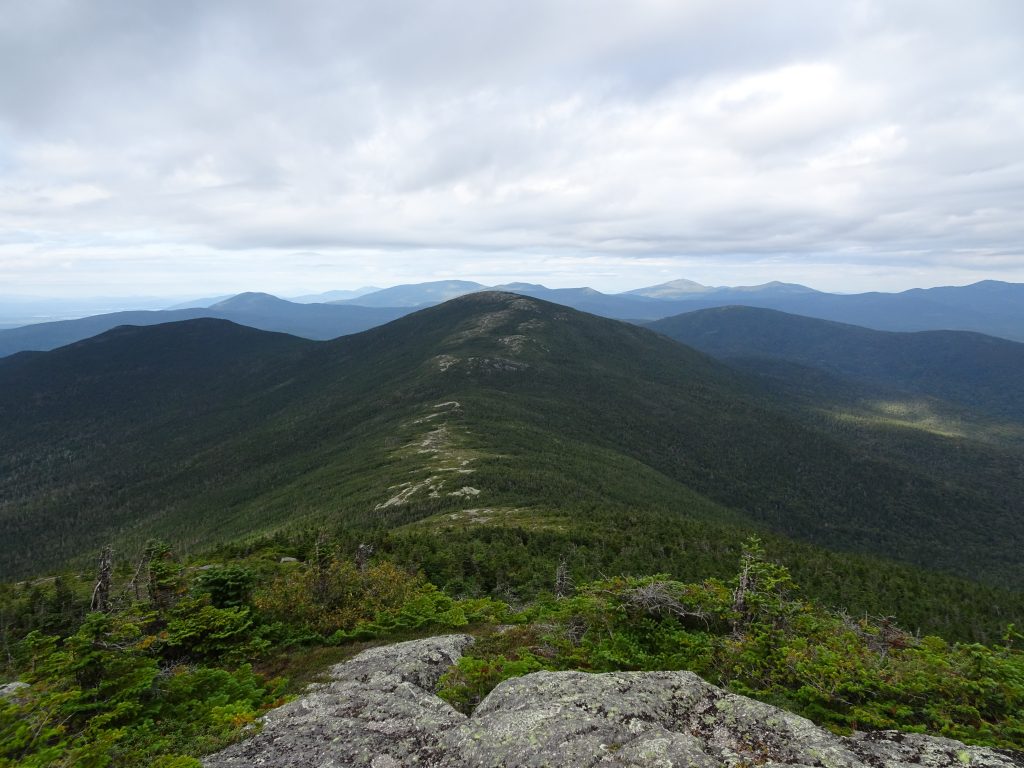
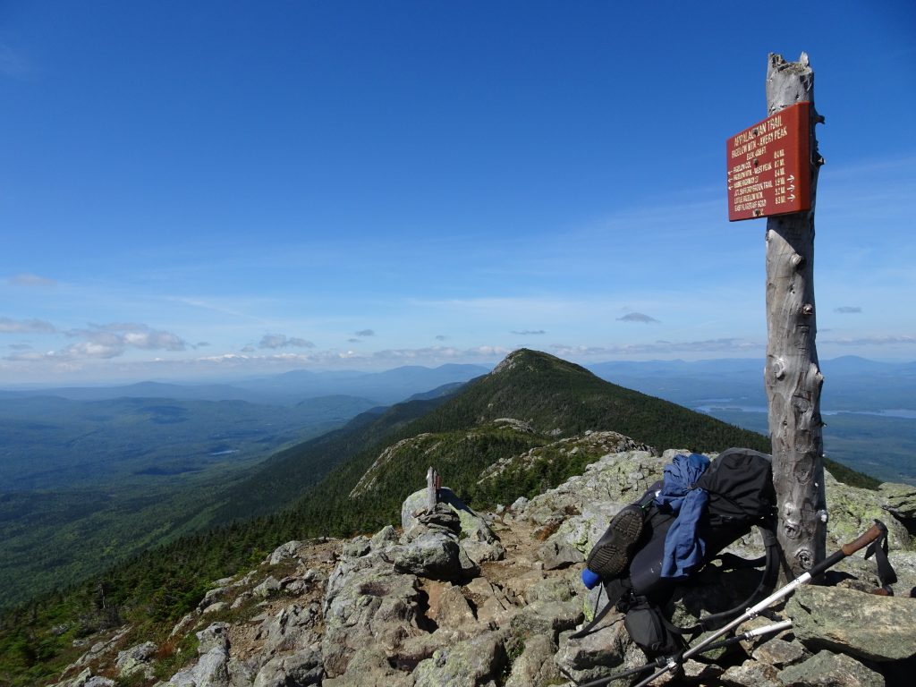
The AT then takes a zig and zag to pick up the Bigelow Mountain range. I did a lot of climbing in the Bigelows, summitting “The Horns” (North and South Peaks), West Peak, Avery Peak, and Little Bigelow Mountain, but was awarded with amazing views. While in the Bigelows, I camped at the nicely-maintained Horns Pond Campsite.
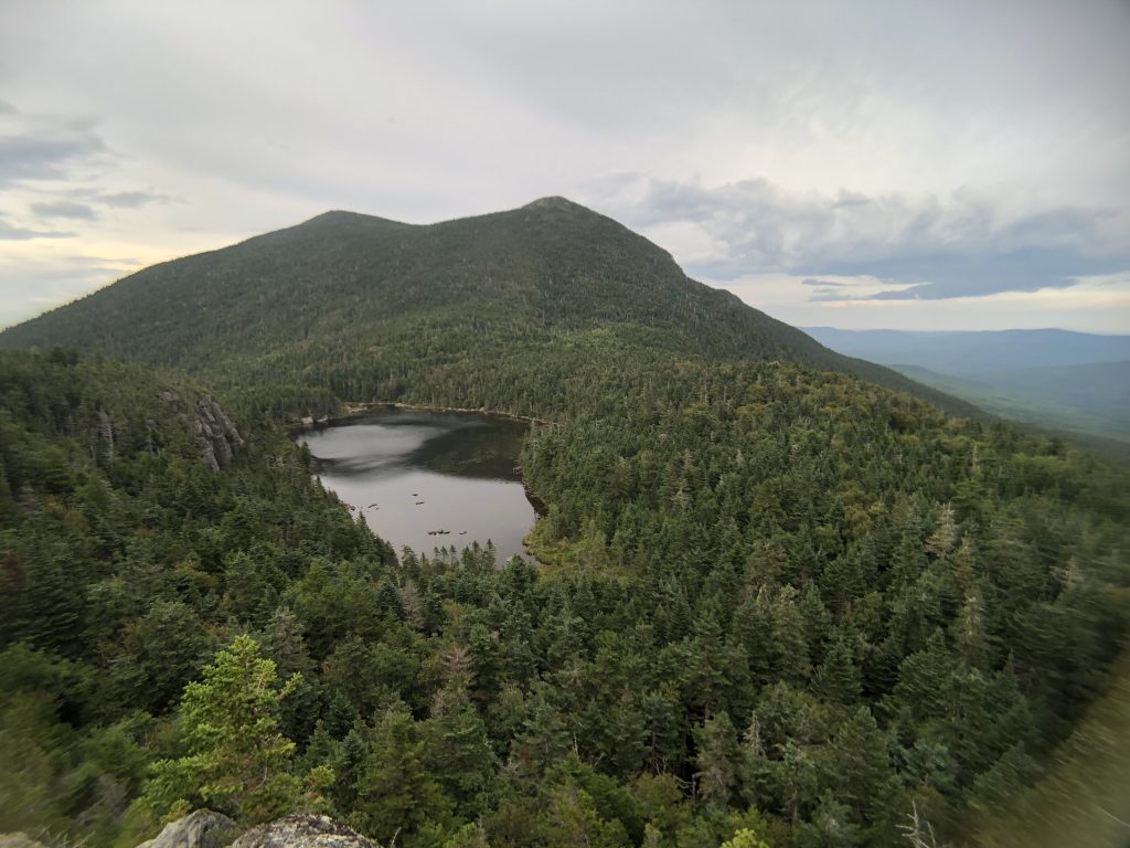
Horns Pond – “The Horns” in the background
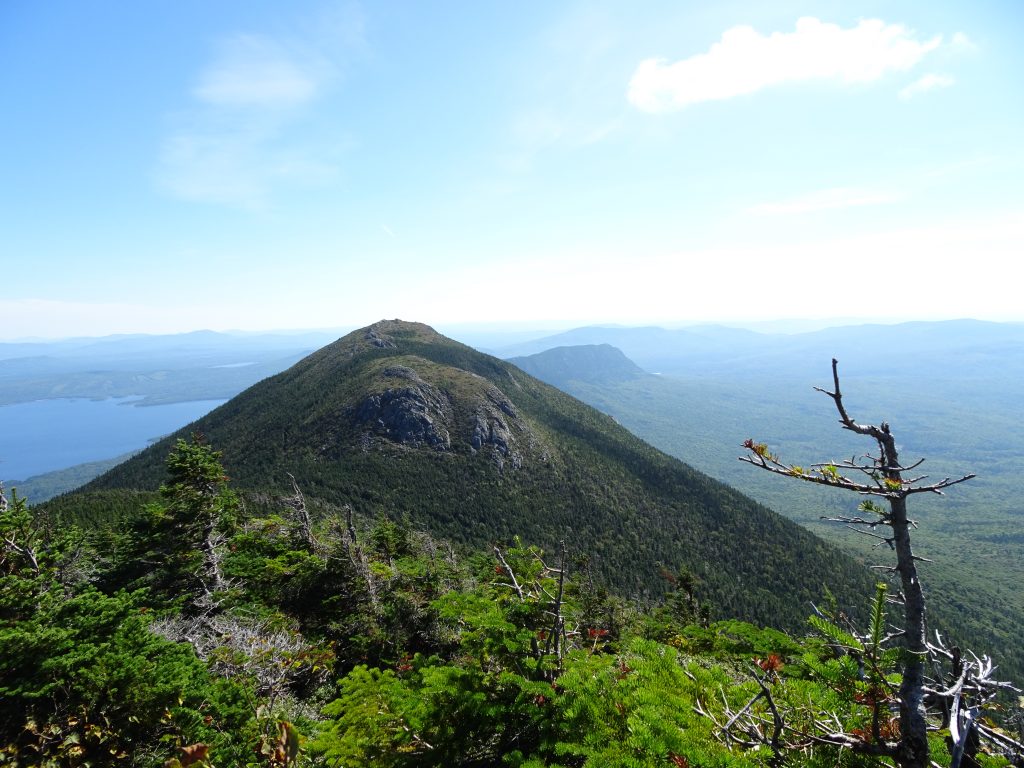
View of Avery Peak from West Peak, Little Bigelow Mountain is the ridge in the background
View back to West Peak from Avery Peak
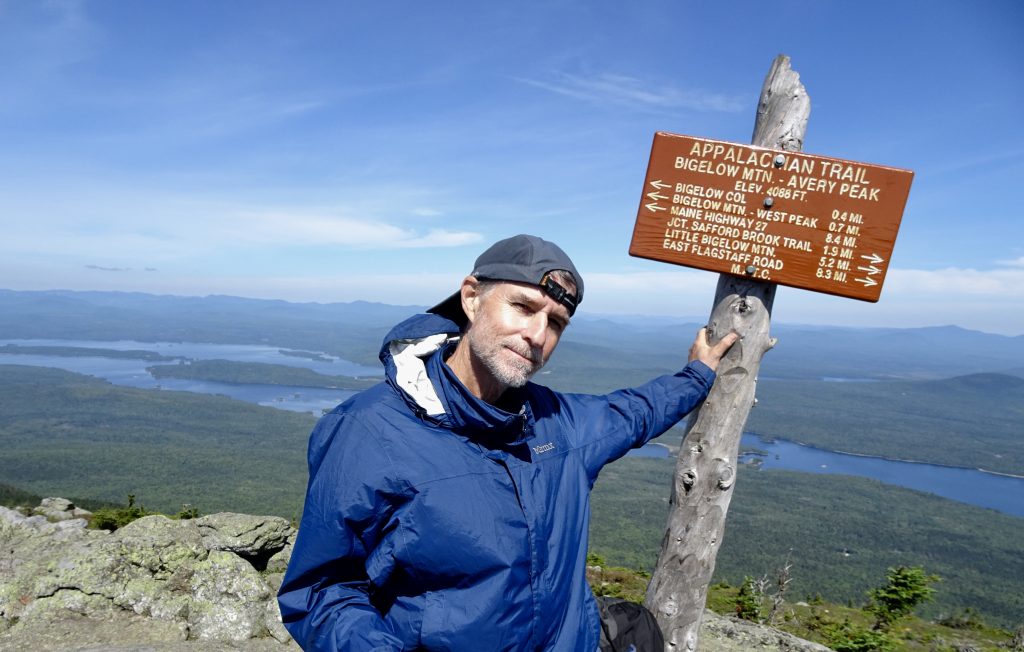
Randy on Avery Peak
View of Flagstaff Lake from Avery Peak
Looking west from the side of Little Bigelow Mountain
Maine is full of streams and lakes, so availability of drinking water is never an issue. Because there hasn’t been much rain lately, I been able to cross almost all streams by hopping rock to rock. Only two times have I had to remove my socks and wade barefoot in my crocs. At the Kennhebec River, the ATC provides a free ferry service to make the river crossing since it is not safe to wade across.
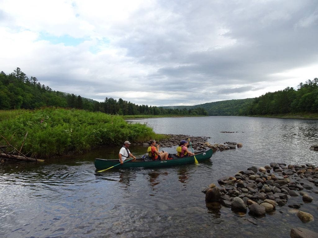
Kennhebec River Ferry
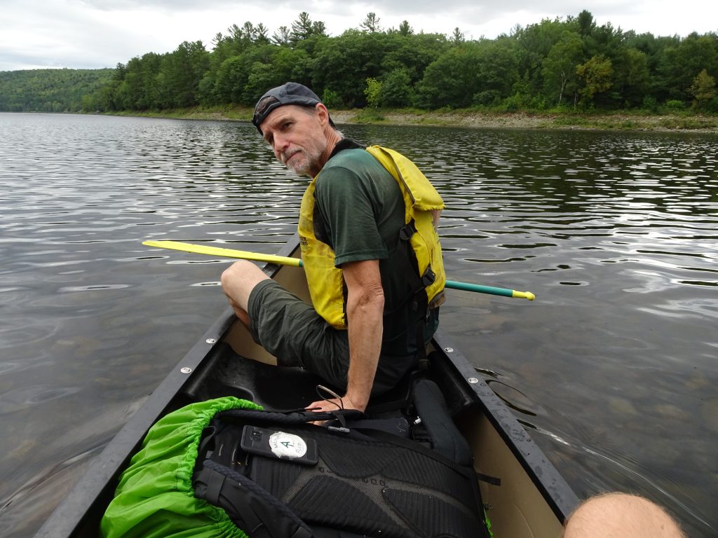
Randy slacking at his job as a paddler
Many of the campsites in Maine are situated by lakes (or “ponds” as they seem to like to call them in Maine,) which provide opportunities to view sunrises and sunsets. It is also a chance to see loons. I have only seen one loon so far, but I hear them every night that I camp near a lake.
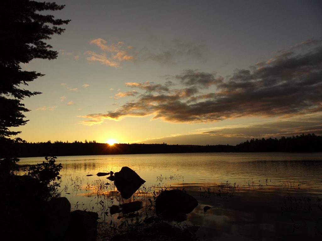
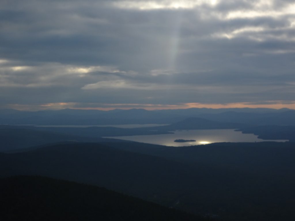
Sunrise on Bald Mountain Pond
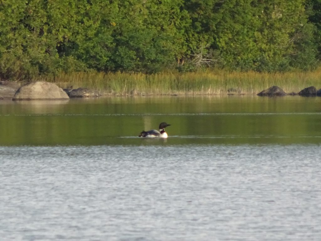
Loon
One nice thing about New Hampshire and Maine has been the availability of full-service hostels, which have been scarce from New Jersey to Vermont. The towns up here are very small, so the hostels are probably a welcome addition to their economy. Also, there are more hikers in the area to support these businesses.
At this point, hikers at the hostels are all business. The mornings are getting cooler, the days are getting shorter, and there are signs that the leaves are beginning to turn. All of this creates a sense of urgency to finish our journey. Hikers spend most of their time resting, reading their guidebooks, figuring out their resupply, and planning the next leg of their hike. In Gorham, NH, (pop. 2,848) I stayed at a hostel called The Barn Hostel. It was a pretty rustic setup with all the bunks upstairs and the common area downstairs.
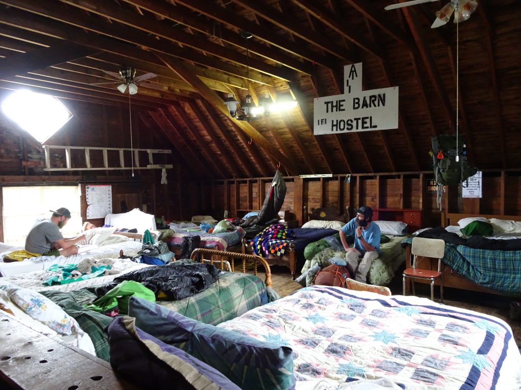
The Barn Hostel
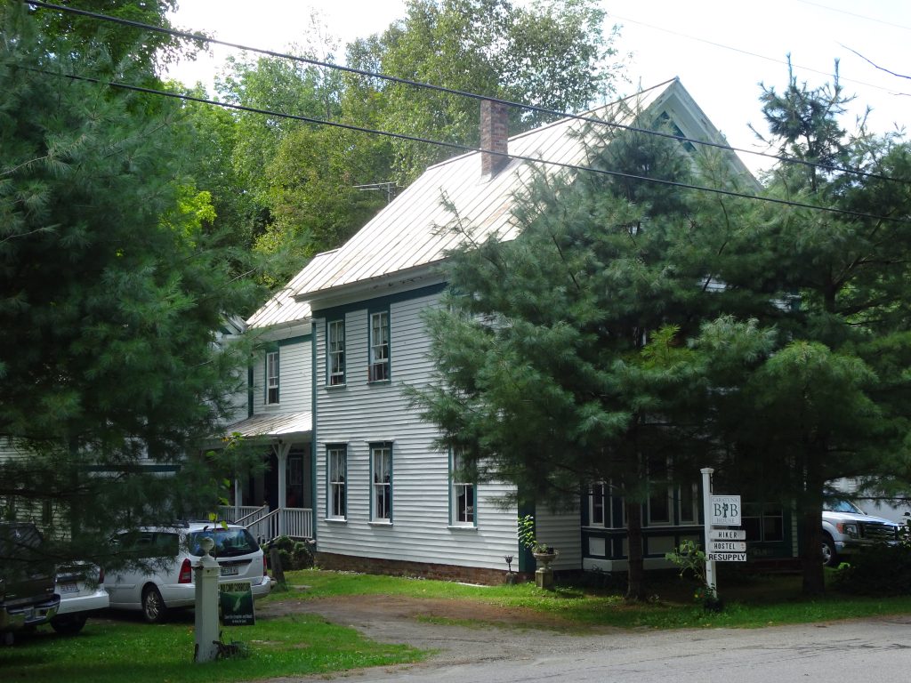
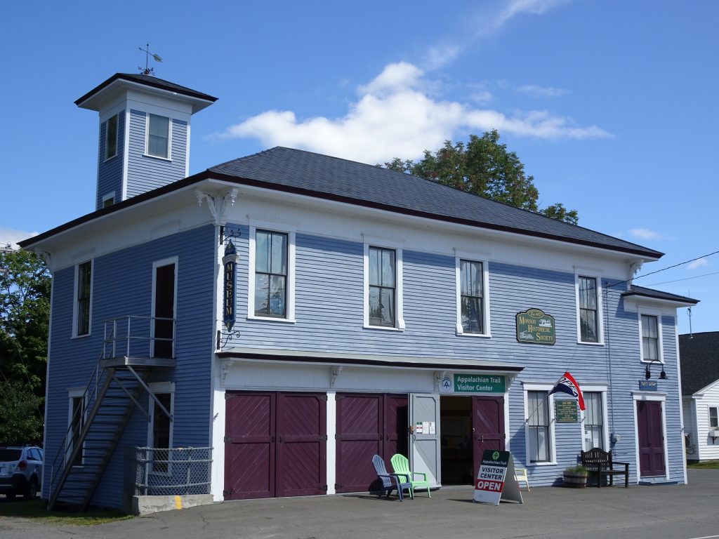
In Maine, the towns got even smaller. I visited the towns of Andover (pop. 821), Rangeley (pop. 1,168), Caratunk (pop. 69), and Monson (pop. 686).
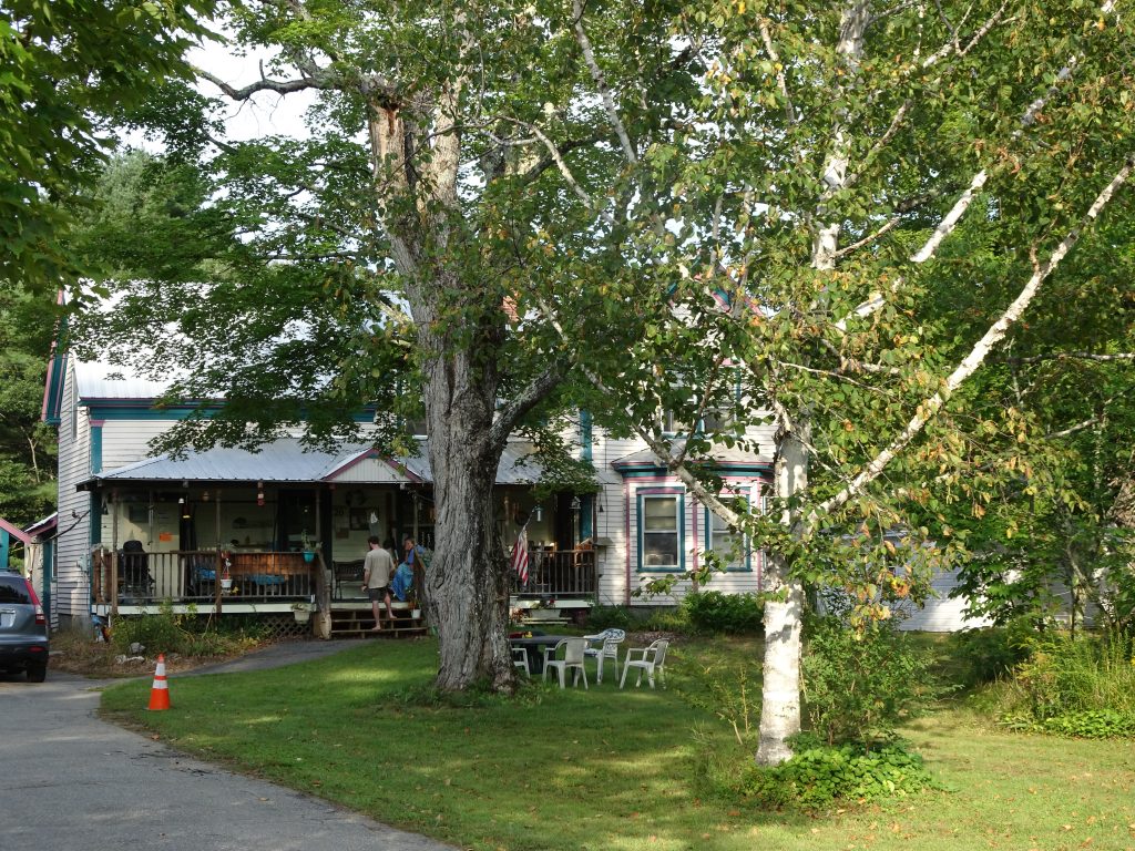
Pine Ellis Hostel – Andover, ME
I hitched into Rangeley to eat some town food and to resupply. The town is known as a fly fishing mecca. It is also somewhat of a geographic anomaly. There is sign in town stating that Rangeley is halfway between the equator and the North Pole. Also, as I pointed out to several residents, the town is built on an isthmus between Rangeley Lake and Haley Pond. The locals seemed oblivious to this “fact” and seemed to have no clue as to what is an isthmus. So maybe it’s really not an isthmus, but it’s close enough for me.
In Caratunk, I stayed at the Caratunk House B&B. The owner told me that when all his beds are full, the population of the town goes up by a third. I mailed home some extra gear from the Caratunk Post Office which only is open weekdays from 2-4 PM. When I mentioned this to Nancy, she pointed out that this would be a good place to work.
Caratunk House B&B – Caratunk, ME
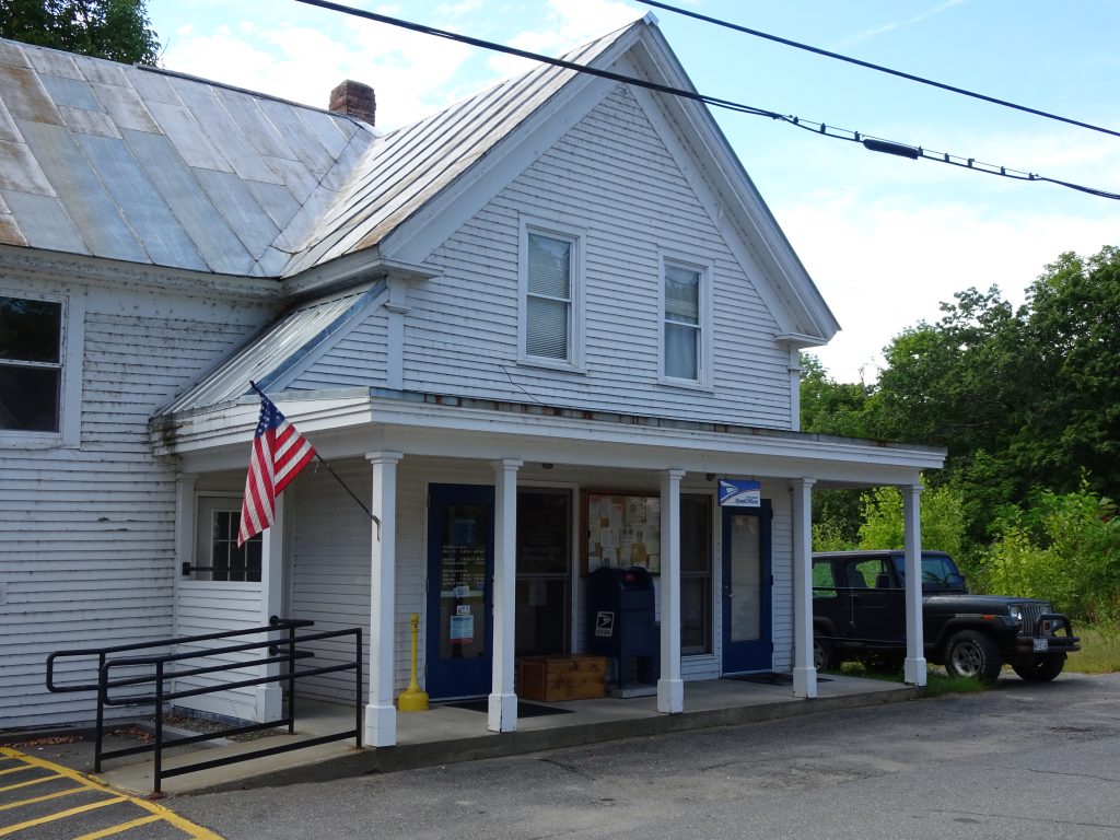
Caratunk Post Office
Monson is the last town before the 100-mile wilderness, so it is a natural place for hikers to stop to rest and resupply. I stayed there at a hostel called The Lakeshore House which sits right on the main drag but backs up to Lake Hebron. The town is extremely picturesque. Everywhere you look, you see a scene that belongs on a post card or jigsaw puzzle box.
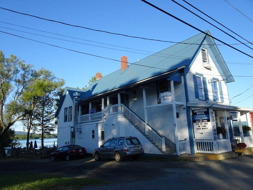
The Lakeshore House, Monson, ME
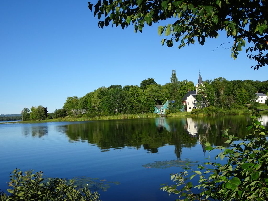
View from the back deck of The Lakeshore House
In Monson, you will find the Appalachian Trail Visitor Center. The people that work at the visitor center were extremely helpful. They could answer any questions on the trail conditions in the 100-mile wilderness as well as help with the logistics for getting up and down Mount Katahdin.
Monson’s Appalachian Trail Visitor Center
The trails in Maine are maintained by the Maine Appalachian Trail Club or MATC. This organization does a great job of keeping the trails in good shape. Their signage is excellent. The MATC always places a sign to mark the top of a mountain. Somehow, I really appreciate seeing the sign after finishing a long climb. I always get a kick out of the Yankee ingenuity the MATC folks employee for their ladders and bridges.
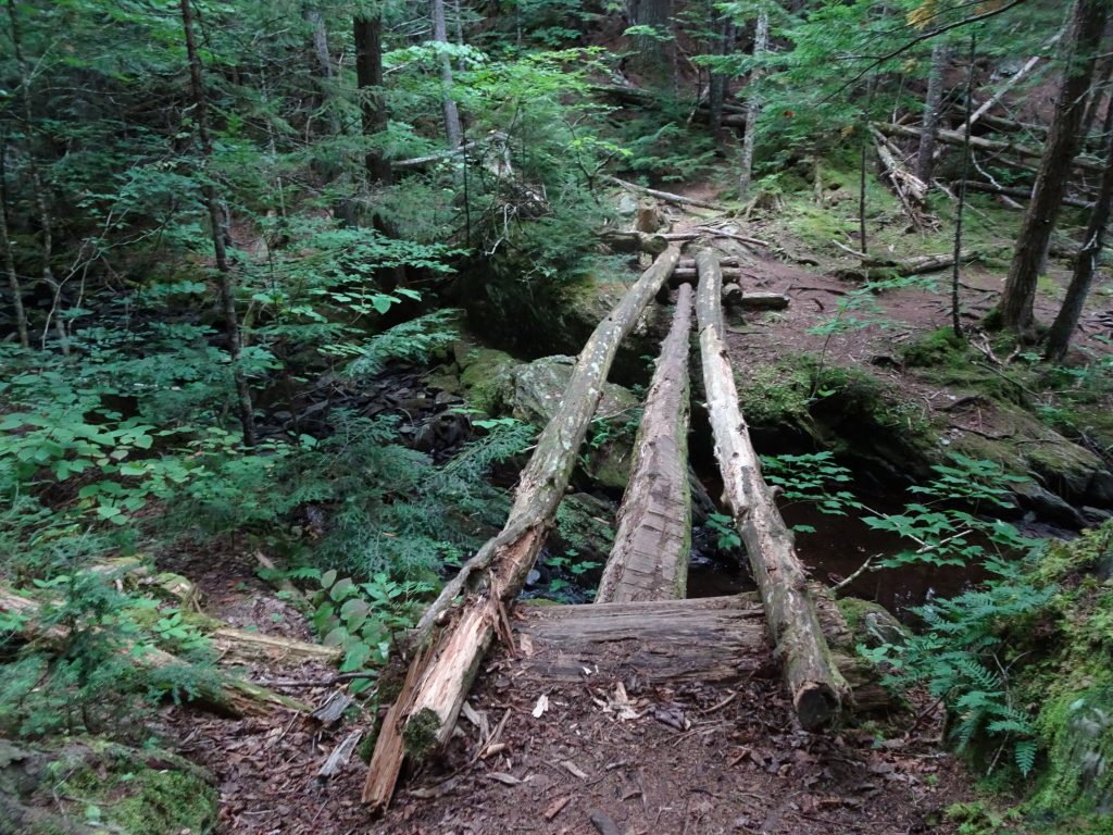
Bridge across a gully
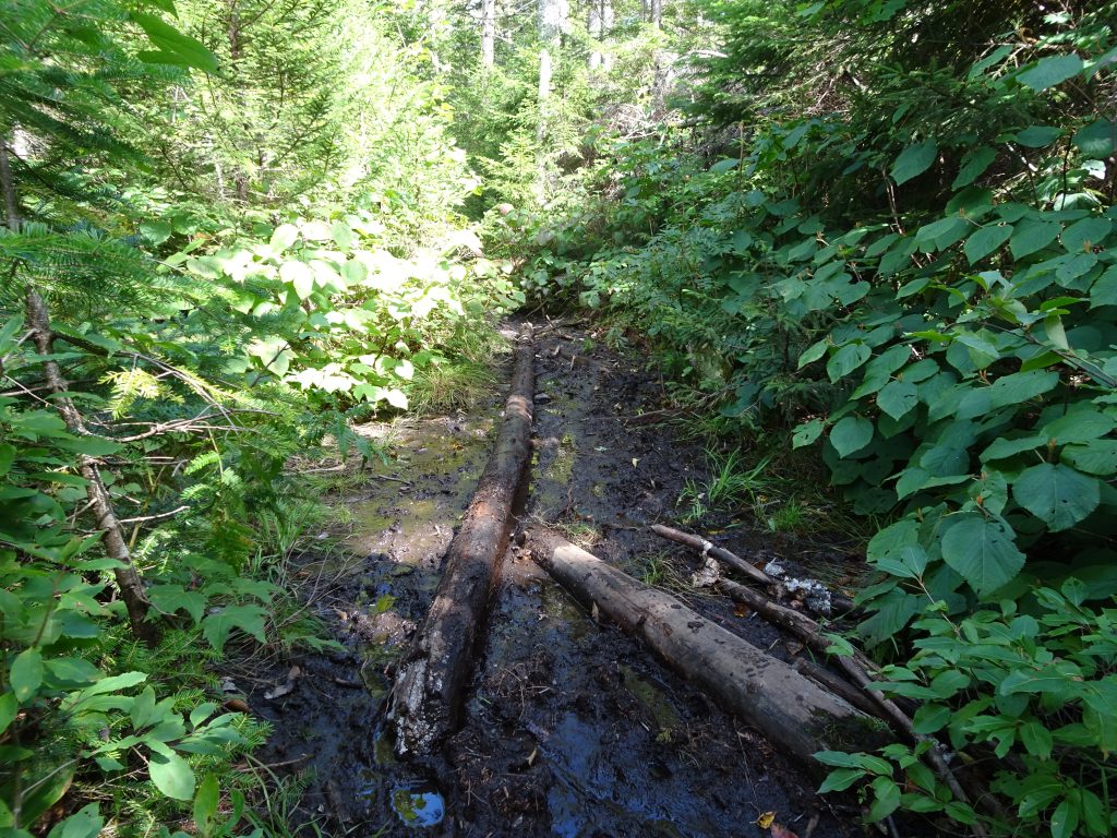
Glad to have the log across the bog, but better have your trekking poles
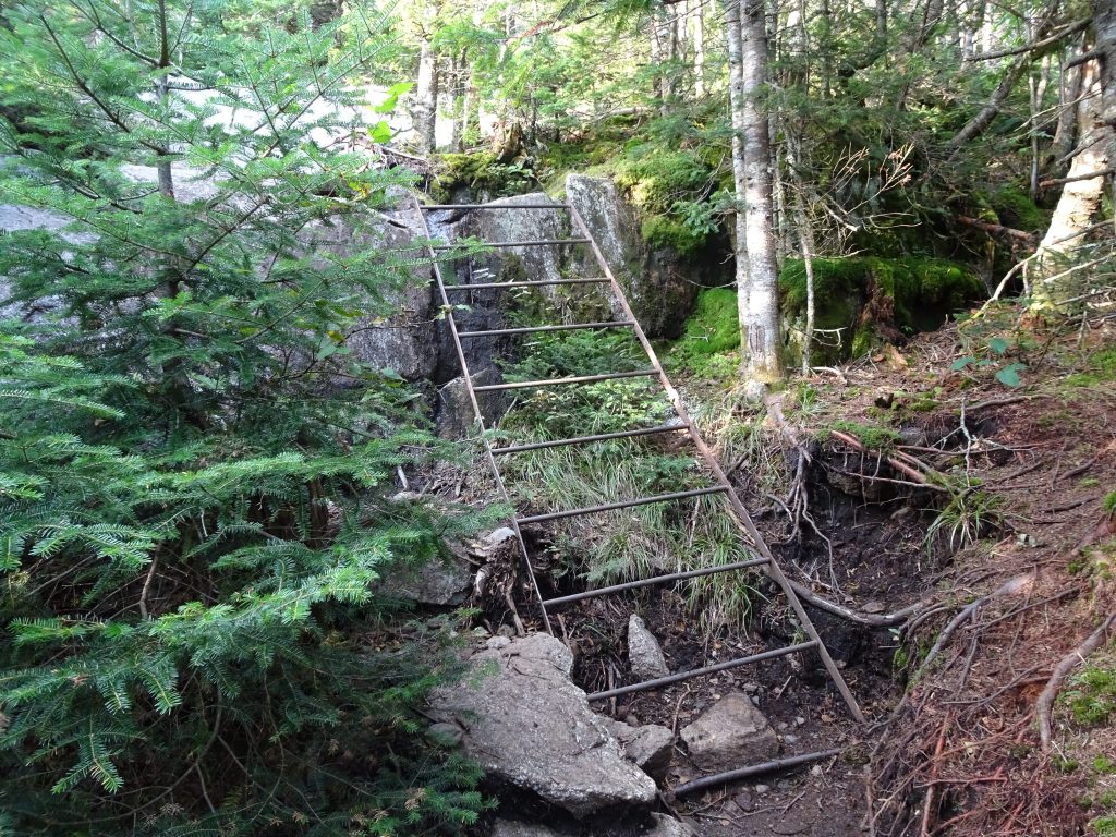
Iron ladder
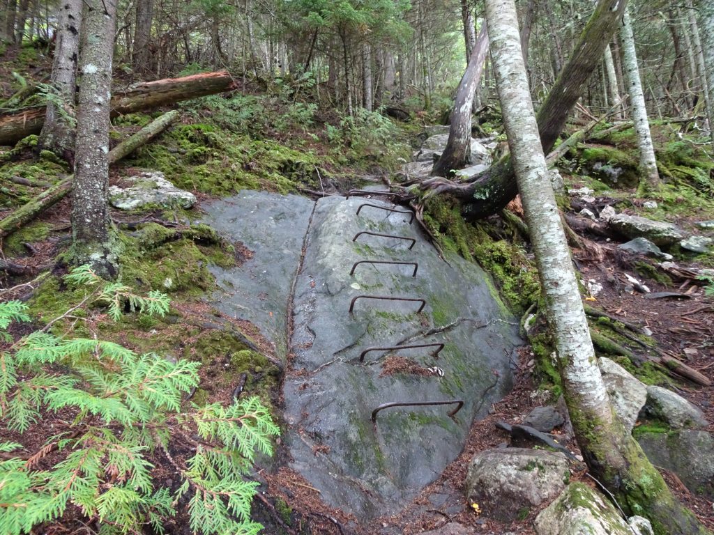
Ladder made from rebar embedded in the rock
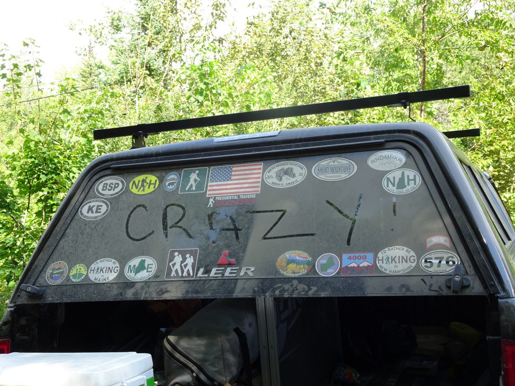
If I thought myself a mountaineer for having hiked the AT, that notion was quickly dispelled when I met a guy with the license plate “GRIDIOT” handing out trail magic. He explained how he and other likeminded peak-baggers are into hiking “grids”. For example, there are 48 4k elevation mountains in New Hampshire. To complete the grid, you must hike each of these mountains in every month of the year. There is no time limit. For the New Hampshire grid, this means 48×12 which multiplies out to 576 summits. He has completed this feat (along with about 80 other people), hence the reason for the “576” sticker on his truck.
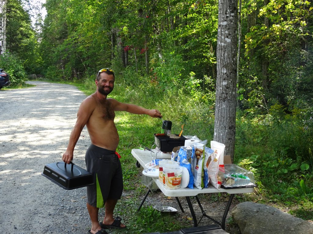
“Gridiot” cooking up the trail magic
Gridiot’s truck
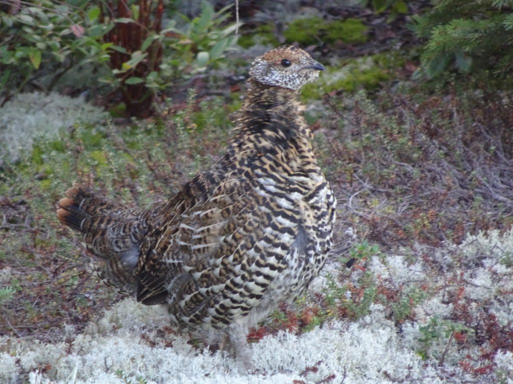
I was able to get some better pictures of the Spruce Grouse, both male and female. These birds don’t seem very afraid of people, which makes them easy to photograph.
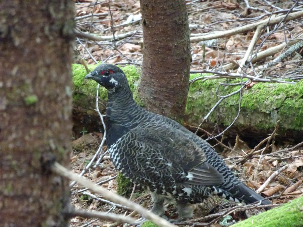
Spruce Grouse (male)
Spruce Grouse (female)
Other flora and fauna…
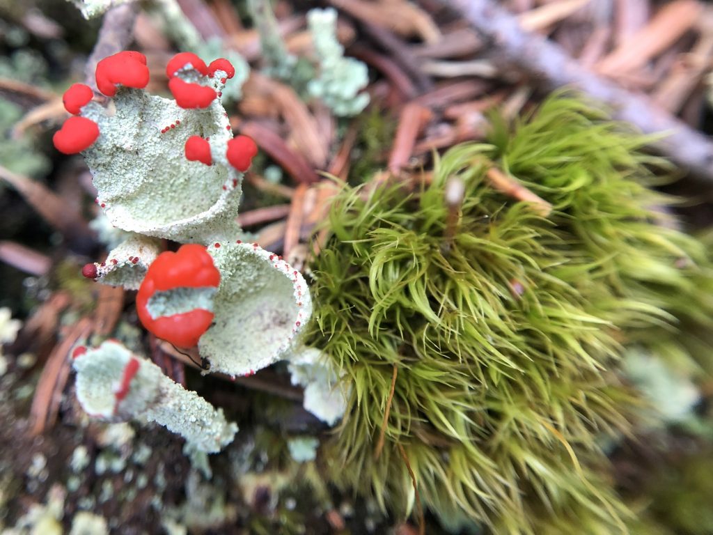
Pixie Cup Lichens
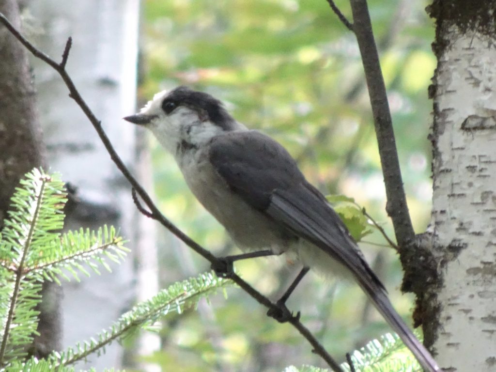
Canada Jay (Gray Jay)
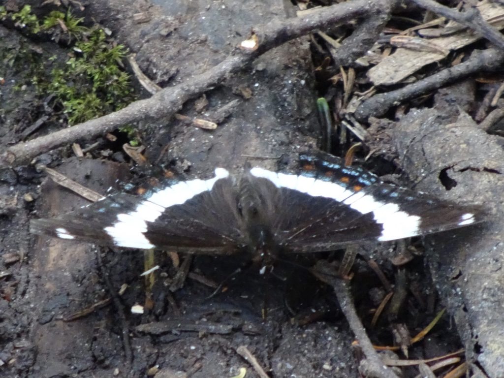
White Admiral Butterfly (Banded Purple)
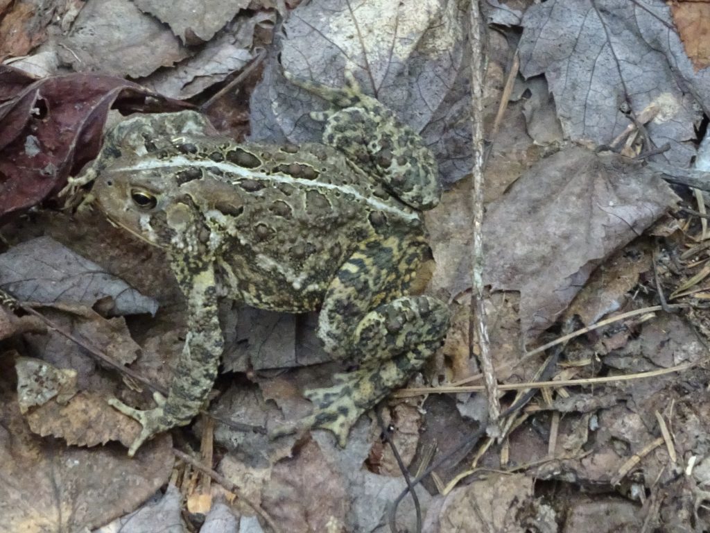
American Toad
If you’d like to receive an email when a new post is up on the blog, click the email icon on the bottom of the page to subscribe. Thanks for following!
Randy I hope you are doing well! You do look thin, so I personally want to fix you a calorie filled meal when you get home!
Really love reading about your journey!
Stay safe!
Randy I hope you are doing well! You do look thin, so I personally want to fix you a calorie filled meal when you get home!
Really love reading about your journey!
Stay safe!
Thanks for all the great stories and pictures Randy. Can’t wait to hear them in person.
Well, this is the one I meant to post the “fall” comment on. Gorgeous photos.